
If you’re searching for a reliable mountain terrain exploration guide, you’re likely preparing for more than just a scenic hike. Mountain environments demand strategic planning, the right gear, and a clear understanding of changing terrain, weather patterns, and safety protocols. This article is designed to give you exactly that—practical, field-tested insights to help you navigate rugged landscapes with confidence.
We break down essential route-planning techniques, terrain assessment strategies, gear preparation tips, and maintenance practices that can make the difference between a smooth expedition and a risky outing. Whether you’re exploring high-altitude ridgelines or venturing into lesser-known wilderness zones, you’ll find actionable guidance tailored to real-world conditions.
Our recommendations are grounded in extensive outdoor research, proven trekking methodologies, and insights drawn from seasoned wilderness explorers. By the end, you’ll have a clear, structured approach to mountain travel—so you can explore farther, safer, and with greater confidence.
Jagged peaks and alpine meadows have a magnetic pull, but mountains are not theme parks. Thin air—meaning lower oxygen at higher elevations—can drain your energy fast. Meanwhile, scree, those loose rolling rocks, turns ankles into complainers. So, before you channel your inner Everest hero, plan wisely. Study weather windows, map water sources, and pack layers for sudden alpine mood swings. A reliable mountain terrain exploration guide helps, yet judgment matters more. Some argue experience alone is enough; however, even veterans check forecasts twice. Pro tip: acclimatize slowly to avoid altitude sickness. Ultimately, preparation turns horizons into unforgettable, not unbelievable, stories.
Blueprint for the Ascent: Pre-Trek Planning
Preparation is the quiet hero of every successful summit. Before lacing your boots, start with route intelligence. Study topographic maps to assess elevation gain (total vertical climb), trail mileage, terrain type, and reliable water sources. For example, a 6-mile hike with 3,000 feet of gain is far more demanding than a flat 10-mile trail. Modern GPS apps like Gaia GPS and AllTrails can overlay contour lines and recent trail reports, but always cross-check with an official mountain terrain exploration guide for accuracy. (Apps run out of battery; paper doesn’t.)
Mastering Mountain Weather
Next, understand that valley forecasts rarely reflect summit realities. Temperatures typically drop 3–5°F per 1,000 feet of elevation gain (NOAA), and wind chill can accelerate heat loss dramatically. Check mountain-specific forecasts and learn to spot warning signs like rapidly building cumulonimbus clouds or sudden wind shifts. When thunder rumbles, descend—immediately.
Finally, create a lifeline itinerary. Leave a written plan with a trusted contact including: planned route, start and end times, bailout points, vehicle location, and emergency numbers. Search and rescue teams rely on this information (and it can save crucial hours). Pro tip: set a clear “call authorities if overdue” time. It removes guesswork when it matters most.
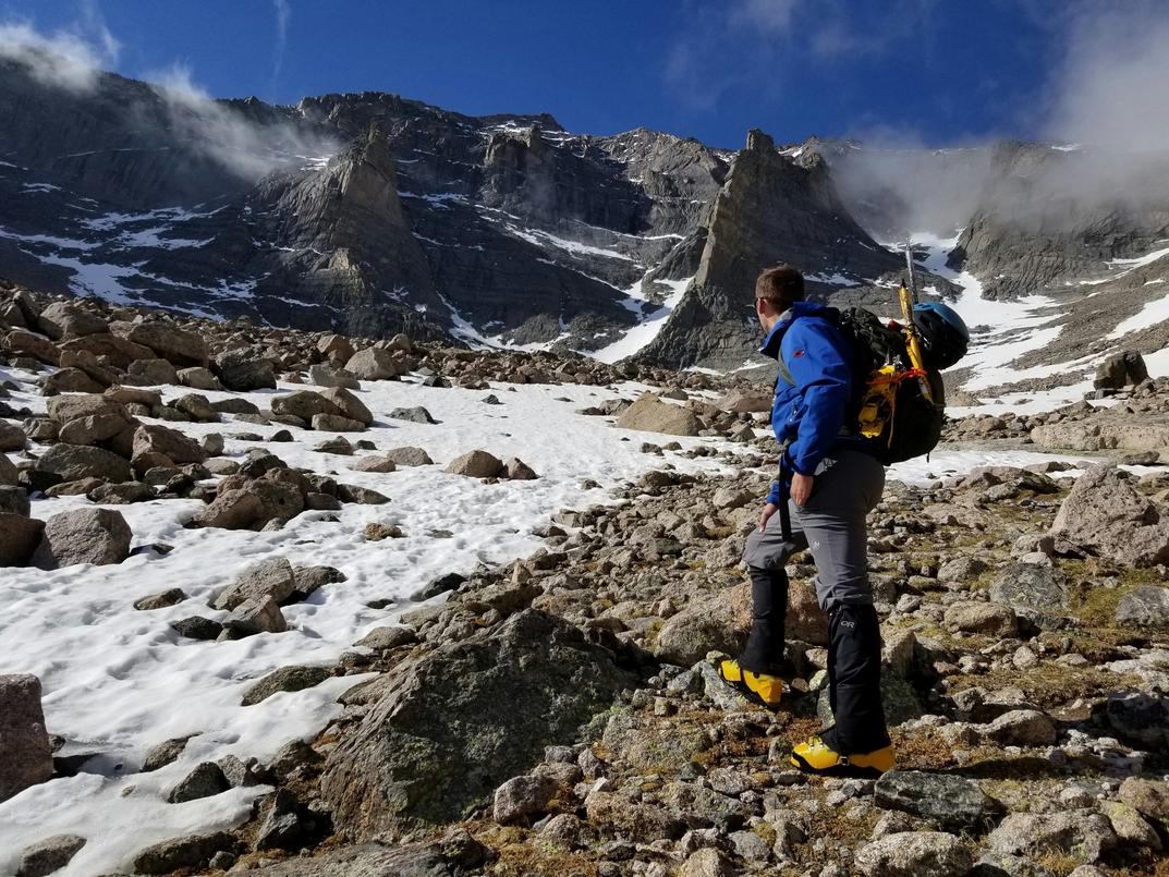
Equipping for Elevation: Your Gear Checklist
I used to think packing was about checking boxes. It’s not. It’s about building a survival system. The Ten Essentials aren’t random items—they’re interlocking safeguards when things go sideways (and they eventually do).
- Navigation (map, compass, GPS): because batteries die.
- Illumination: headlamp over flashlight—hands-free matters when you’re scrambling.
- Sun Protection: hat, SPF, sunglasses; snow glare is ruthless.
- First Aid: blister care is not optional. I learned that the limping way.
- Repair Kit/Tools: duct tape has saved more trips than bravado.
- Fire: lighter plus backup matches.
- Emergency Shelter: bivy or tarp when weather turns cinematic.
- Extra Food: bonking at altitude is humbling.
- Extra Water: and a way to purify more.
- Extra Layers: because forecasts lie.
Think of it as your personal mountain terrain exploration guide—redundancy over optimism.
Foundation First – Footwear and Socks
I once chose stiff boots for a dry, well-groomed trail. Overkill. On rocky, unstable terrain, boots shine for ankle support. On maintained paths, trail runners reduce fatigue. The real hero? Wool or synthetic socks. Cotton traps moisture, friction follows, blisters bloom (ask my heels).
The 3-Layer Clothing Strategy
Layering is thermoregulation science. A moisture-wicking base layer moves sweat off skin. An insulating mid-layer (fleece or puffy) traps warm air. A waterproof/windproof shell blocks precipitation and wind chill. I once hiked in a single thick jacket—sweated uphill, froze downhill. Layers let you adjust before discomfort becomes danger.
Mistakes teach fast. Pack smart so the mountain doesn’t have to.
Wilderness Wayfinding: Navigation Techniques
Analog Failsafes – Map and Compass
Electronics fail. Paper doesn’t (unless you drop it in a river—laminate it). A topographic map shows terrain features using contour lines, while a bearing is the direction from one point to another measured in degrees.
To orient your map:
- Lay it flat.
- Place your compass on top.
- Rotate the map until the compass needle aligns with north on the map.
To take a basic bearing, point the compass toward your destination, rotate the bezel to align with north, then follow the direction-of-travel arrow. Simple. Reliable. No batteries required.
Digital Tools for the Modern Trekker
GPS devices and smartphone apps provide real-time tracking and route confirmation (incredibly reassuring when trails vanish). Their weakness? Battery life.
Mitigate it by:
- Carrying a power bank
- Switching to airplane mode
- Lowering screen brightness
Pro tip: Download offline maps before leaving service areas.
Reading the Terrain
Natural navigation ties everything together. Use handrails—linear features like rivers or ridgelines—to guide movement. Identify landmarks from your map before hiking. Notice how valleys funnel travel and ridges create boundaries.
Studying a mountain terrain exploration guide sharpens this skill.
If traveling near cliffs or shorelines, review coastal wilderness adventures navigating tides and cliffs: https://havajazon.com/coastal-wilderness-adventures-navigating-tides-and-cliffs/
Terrain always tells a story. Learn to read it.
On-Trail Awareness and Safety Protocols
First, let’s talk altitude. Acute Mountain Sickness (AMS) is a condition caused by ascending too quickly to higher elevations, where oxygen levels drop. Early symptoms include headache, nausea, dizziness, and unusual fatigue. The golden rule? If you feel unwell, don’t climb higher. If symptoms worsen, descend immediately. According to the CDC, gradual ascent significantly reduces AMS risk. In other words, the summit will still be there tomorrow (your health might not).
Equally important are wildlife encounters. Store food in bear canisters or use proper hangs at least 200 feet from camp. Keep a safe distance—100 yards from bears, 25 from most other wildlife, per National Park Service guidance. Admire, don’t approach.
Finally, follow Leave No Trace principles: pack out all trash, respect wildlife, and leave nature as you found it. A reliable mountain terrain exploration guide reinforces these details, turning smart preparation into safer, more rewarding adventures.
Your Journey to the Summit Begins Now
You’ve learned the fundamentals; now it’s time to apply them. Some argue that mountains should be approached spontaneously—that overplanning drains the magic (the “just wing it” philosophy). However, wilderness risk is real, and preparation doesn’t dull adventure; it sharpens it. By studying terrain, packing deliberately, and navigating with awareness, you shift uncertainty into calculated challenge. In other words, you don’t remove risk—you manage it. Think of this mountain terrain exploration guide as your blueprint. With foresight and steady judgment, each ascent becomes less gamble, more growth. So plan boldly, step carefully, and claim the summit.
Ready for Your Next Ascent
You set out to master the challenges of rugged landscapes—and now you have the clarity, tactics, and confidence to do it right. From reading shifting weather patterns to choosing reliable gear and applying smart trekking strategies, this mountain terrain exploration guide has given you the practical insight you were searching for.
Unpredictable terrain, poor preparation, and equipment failure can turn an incredible adventure into a dangerous one. That’s the pain every outdoor explorer wants to avoid. With the right knowledge and consistent preparation, you don’t just explore—you explore safely, strategically, and successfully.
Now it’s time to act. Put these techniques into practice, upgrade your essential gear, and commit to smarter route planning before your next expedition. Thousands of outdoor enthusiasts rely on proven strategies and field-tested recommendations to elevate their wilderness experiences.
Don’t let uncertainty hold you back from your next summit. Equip yourself properly, refine your approach, and start planning your next mountain challenge today.